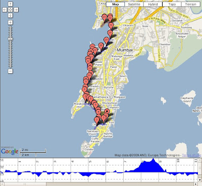
I found the Mumbai marathon route created online using google maps (using the Gmap Pedometer software) posted by a fellow blogger Blogdoctor . The route can be accessed at the below location:
http://www.gmap-pedometer.com/?r=597500
 This will give an idea about the actual distances on the routes, and can help you plan your race strategy. On the left hand side of the map, you can turn on the elevation to see exactly at what point in the run do those big hills come. As you can see above, the hills are between the 7K and 9K marks (Peddar road), and then at the 35K to 37K mark (same Peddar road section on the way back). The ascent is almost 50 meters. On the left is the actual published route.

Leave a Reply